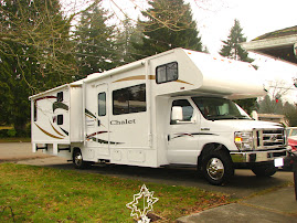
 Cheryl had a counseling conference in Kansas so the Kaler's loaded up and took Cheryl to St. Louis for the day before returning to the dorms. We were able to visit three new states. The first was Indiana. Wait, wasn't Abe born in Kentucky and wasn't he really from Illinois? We learned more about Abe's childhood on the drive. He was born in Kentucky, moved to Indiana when he was eight and lived there until he was 21. It was then that he moved to Illinois. Each state likes to claim him as their own of course!

Cheryl was driving so Greg got the chore of trying to take the state sign picture while driving. You can see the result here. Personally, I (Greg) think the picture is very artistic. You can see the Illinois state sign in the background (sort of). Shayna thought that the States try to annoy the travelers by having the welcome signs in difficult locations to photograph.

Another "artistic" shot of a welcome sign. This time it's Missouri.

The Jefferson National Expansion Memorial otherwise known as the Gateway Arch in St. Louis, Missouri. Big thanks to our friend Barb for taking such good care of all the Kaler's on this trip. Barb and Cheryl continued to Kansas from here.
 Under the Arch is a huge museum that comemorates the westward expansion of settlers. St. Louis was considered the "Gateway" to the West. Scores of settlers began their trek westward here and across the state in Independence. Here we learned about the peace medals that the settlers gave the Native Americans to build peaceful relationships. Sadly they were often used as tools to rob the Native Americans of their skills, produce and land.
This is Pioneer Pete. He was great! He taught us what daily life was like for families on the trails. Here he is showing us one of the toys that kids often played with. He told us about the hand cart that some of the older folks like him might pull on the trip. They would pull these carts that weighed hundreds of pounds about 15 miles a day. This normally took all day. He also told us about the job that the kids had every day when they arrived at camp... collecting Buffalo chips to burn in the fire. In the picture below Greg is holding one.

He also taught us about the four major trails that went westward. Can you name them? I'll give the answers below.


Since the Memorial is ran by the National Parks Service, the kids participated in the Jr. Ranger program. They are being sworn in by the Ranger here after completing their booklet.
 The brave Kaler's (and Barb) decided to go up the Arch this time. Puffkins and McSquizzy are getting weighed here in the waiting area. Looks like McSquizzy has few ounces on Puffkins.
The Arch stands 630 feet high and there is 630 feet between the two bases of the Arch. You have a pretty good view of the city and the surrounding area from this height. McSquizzy is looking down at Busch Stadium, home of the St. Louis Cardinals. This stadium just hosted the MLB All Star Game last summer. I wonder how many fans took in the game from this vantage point?


This is the Old Courthouse Building. It's part of the park so we thought we'd check it out as well.


A few more Arch pictures before we head to the Old Courthouse Building.


Do you see the reflection of the courthouse on the glass building across the street? We thought it was pretty cool.

View of the rotunda. There was some beautiful artwork

We were all pretty beat from the long day of travel and the excitement of the Arch so it was just a quick look around the courthouse and then back to the car for the trip home. This was the view from the courthouse steps.
So what were the four major trails leading westward?
1. The Oregon Trail. I hope you all got that one (especially our Oregon readers...Mom that's you). This trail covered 6 states and over 2000 miles. It took settlers about four months to make the journey.
2. The California Trail. Settlers on this trail followed the Oregon Trail to Idaho and then would head South from there. Many of the Settlers on this trail were part of the Gold Rush. They were often referred to as 49ers.
3. The Santa Fe Trail. This trail of 780 miles was used by traders and the military.
4. The Morman Trail. The Mormons used this trail in search of a place to worship in peace without persecution. They eventually ended in up in what is today Salt Lake City some 1,300 miles from Missouri.
If you want a little more details description of the four trails try this: www.mrnussbaum.com/history/trails.htm


1 comment:
Looks like you get to add a couple more states to your map. We just added 4 more and that thrilled my kids to no end. Finally!:) Looks like your trip was a lot of fun. Loved the pics of the arch!:)
Post a Comment